Sites of Violence, Traces, and Digital History Culture | »The ›Emsland Camps‹ as a Conflict Landscape in Transformation«, Osnabrück and Dalum, 24 and 25 September 2026.

By Christoph Rass · Originally published on nghm.hypotheses.org
Introductory essay for the conference “The ‘Emsland Camps’ as a Conflict Landscape in Transformation,” Osnabrück, 24 September 2026.
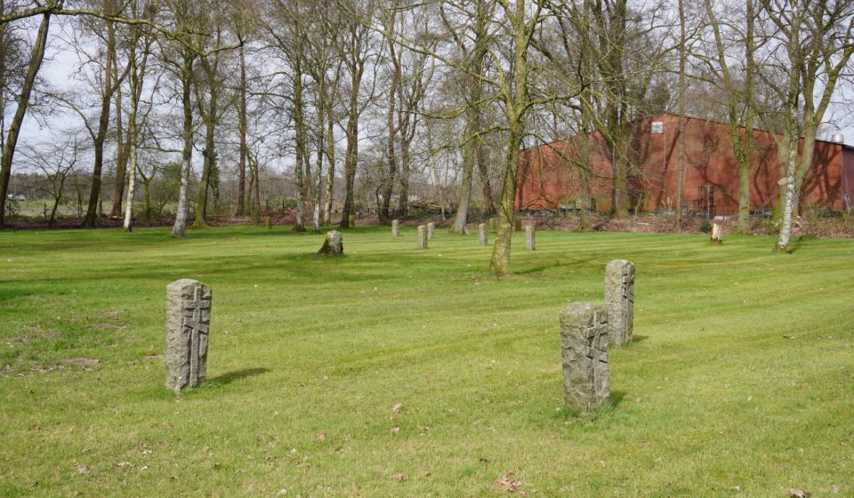
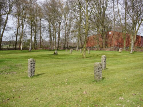
To the north of Camp XII Dalum, whose grounds today lie largely beneath an industrial estate, the Wehrmacht established a cemetery in September 1941 on a plot that had previously served as a Reich Labour Service camp. Until the summer of 1943, it buried its dead there — more precisely, the killed Soviet prisoners of war from five camps: Dalum, Groß Hesepe, Alexisdorf, Wietmarschen, and Bathorn. Initially, individual graves were dug; as the prisoners were left to die in their thousands in the camps, the Wehrmacht turned to mass graves. While estimates based on burial registers vary between eight and sixteen thousand dead, the Esterwegen Memorial, based on current research, assumes approximately ten thousand victims, almost all without names.1 An obelisk bearing a Soviet star, which the cemetery had received after the war, was removed during its redesign in the 1950s on account of the Cold War; who this “one” was remains among the questions the cemetery poses to this day. Those who visit the site today — officially designated a ‘war graves site’ (Kriegsgräberstätte) — will find neither marked grave plots nor the monument that once commemorated them. The Dalum cemetery presents itself as a multiply overlaid site that has passed from a Reich Labour Service camp through a camp cemetery and war graves site to a place of remembrance, today bearing the appearance of a cemetery maintained by the German War Graves Commission (Volksbund Deutsche Kriegsgräberfürsorge).
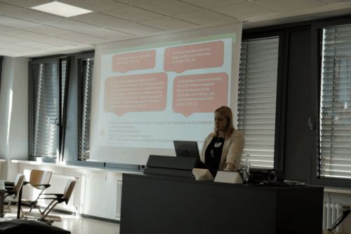
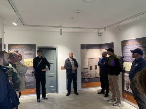
It is this gap between the invisible traces of violence and what a site reveals today that the concept of the conflict landscape addresses — a concept with which we have been working in the Interdisciplinary Research Group on Conflict Landscapes (Interdisziplinäre Arbeitsgruppe Konfliktlandschaften) at the University of Osnabrück since 2014/15. It formed the starting point of the introductory address at a conference at which we presented the project “The ‘Emsland Camps’ as a Conflict Landscape in Transformation” on 24 and 25 September 2026 in Osnabrück and Dalum, and submitted its findings to date for discussion.
This contribution summarizes the argument of the introductory address in three steps. First, we define the concept of the conflict landscape as an analytical category and demonstrate, through two case studies, the perspectives it opens up. A second step explains why it must prove its value precisely at the camp sites subsumed under the name ‘Emsland Camps.’ The perspective then shifts to the project that is making these sites digitally accessible and in doing so intervenes in the very production of history that it sets out to examine.
Conflict Landscapes as an Analytical Category
Our interest lies in the relationship between the material overlaying of a site by violence and the discursive production of its meaning, but above all in the interactions between these two dimensions. We therefore understand a conflict landscape as a socioculturally definable space that has been overlaid by violent conflict and in which the traces of that conflict persist both materially and immaterially, while people continuously reshape it and contest its interpretation. Material traces do not speak for themselves; they become evidence only when narratives, designations, and commemorative practices frame them. At the same time, the production of history intervenes in the materiality of the site — through the reburial and redesign of remains, through the erection and removal of monuments, through illegal excavation or the establishment of memorial sites, and of course through our own work, which interprets a site of violence the moment it surveys, names, and represents it, and which, where it proceeds archaeologically, also alters its materiality.
The involvement of research must therefore be included in the findings. The concept thus designates not a type of place that could be circled on a map, but a relationship between space, trace, and interpretation that calls to be reconstructed. In this sense, conflict landscapes can be read as dynamic palimpsests in which the layers of violence, its aftermath, and their respective interpretations are superimposed upon one another. We developed this approach through many years of research on the ‘Hürtgenwald.’ The insight that what happens to a site of violence after the event matters as much to its understanding as the event itself is equally indebted to the long-standing collaboration between the Department of History and the Museum and Park Kalkriese at the site of the Battle of the Teutoburg Forest, out of which the research group emerged in 2014/15.2
The Hürtgenwald and the Karya Railway Station
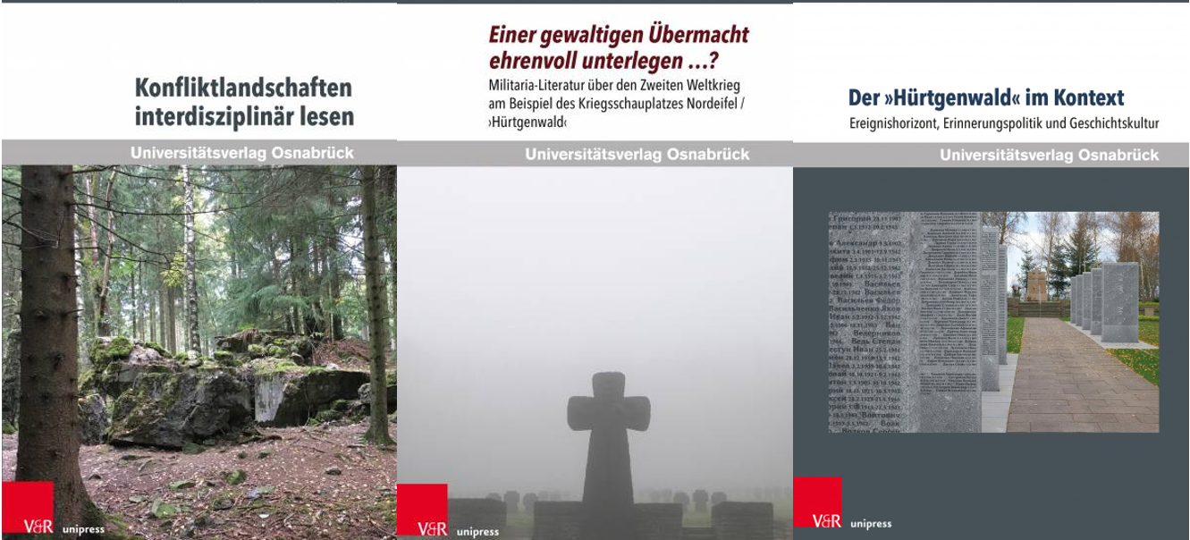
Two sites of violence that we have studied intensively in recent years illustrate the directions in which the interaction of materiality and interpretation can unfold. In the Hürtgenwald in the northern Eifel, interpretation shapes matter. For a series of engagements in which the US Army and the Wehrmacht faced one another between September 1944 and February 1945, the designation ‘Battle of the Hürtgen Forest’ only established itself after the war. The forest was already present as a site of the fighting at the time, but none of the parties involved spoke of a ‘battle.’ From the 1950s onwards, militaria literature — not infrequently written by Wehrmacht veterans and authors close to them — disseminated a narrative under this name that portrayed members of the Wehrmacht as heroes. This narrative shapes the forest to this day, and in an entirely material sense. Reenactors, for instance, construct trench systems based on photographs that the literature attributes to the Hürtgenwald but which in fact originate from the Italian theater of war; subsequent visitors read these interventions in the ground as authentic traces and compare them with the very photograph that seems to authenticate them. The third volume of the book series “Konfliktlandschaften” [Conflict Landscapes], which we publish as a research group through Universitätsverlag Osnabrück, presents the conclusion of this work; the volume is available open access.3
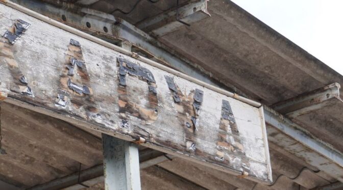
The situation is different in Karya in central Greece. There, in the spring of 1943, the Organisation Todt — the National Socialist state’s construction organization — forced between 300 and 500 Jewish men from Thessaloniki, who had been abducted by the German occupying forces, to excavate a hillside cutting more than twenty meters deep for a passing loop, under lethal conditions. At the former railway station, only isolated remnants of the rail infrastructure and the cutting in the hillside remain. Here the landscape carries a history that it cannot tell on its own. We attempted to render it legible through a field survey conducted with students in the spring of 2023, and through the exhibition »Karya 1943. Zwangsarbeit und Holocaust« [»Karya 1943. Forced Labor and the Holocaust«], to which we contributed.4 We pursue similar questions about such interrelations at sites of German extermination policy in Belarus — in long-standing collaboration with the History Workshop Minsk — as well as at sites of the Shoah in Ukraine.
The Camp System in the Emsland
The name ‘Emsland camps’ encompasses fifteen camps: twelve in what is today the Emsland district and three in the county of Bentheim. From 1933 onwards, the SS established concentration camps there, which it guarded until 1936. The penal detention camps, which were under the supervision of the justice administration from 1934 to 1945, were guarded by an SA unit that had been transferred into the justice service — the so-called ‘Moor-SA’ [Moorland SA]; the prisoner-of-war camps of the Wehrmacht High Command existed from 1939 to 1945. According to the Esterwegen Memorial, the SS, the justice administration, and the Wehrmacht held approximately 80,000 concentration camp prisoners and penal detainees, as well as well over 100,000 prisoners of war, at these sites. More than 20,000 people from various European countries died in the camps.5
How rapidly authority passed from one institution to the next at a single camp site is illustrated once again by Dalum. The justice administration had the camp completed in May 1939 for 1,500 penal detainees, but did not occupy it again before the outbreak of war. In September 1939 the Wehrmacht took it over as a prisoner-of-war camp; in 1942 the Luftwaffe established an equipment depot within it; and in January 1945 the SS finally turned it into a satellite camp of the Neuengamme concentration camp. After 1945, this sequence continued as a succession of uses, as several camps were used to house Displaced Persons. Esterwegen served the British as an internment camp until 1947, then until 1951 as a penal institution of the German justice system for Nazi perpetrators convicted by the denazification tribunals of the British Zone, from 1953 to 1959 as a transit camp for refugees from the German Democratic Republic, and from 1963 to 2001 as a depot of the Bundeswehr.6
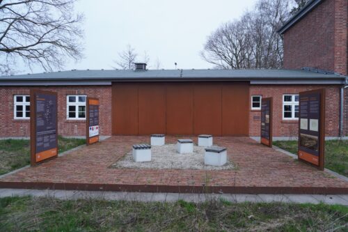
The extent to which use and overwriting have rendered the camps invisible varies from site to site. The grounds of Camp II Aschendorfermoor are today occupied by an arable field, beneath whose soil the traces of the camp can be archaeologically demonstrated. The settlement of Neugnadenfeld stands over the Alexisdorf camp, while a commercial and industrial estate covers the greater part of the Dalum camp; the transformer station and the guardhouse there have been accessible since 2023 as the memorial site “Camp XII Dalum.” In Versen and Groß Hesepe, the succession of uses continues into the present day, as camp barracks still stand on the grounds of the Meppen and Lingen correctional facilities. In Oberlangen, a memorial pavilion on the former camp grounds has provided information since 2014; in Esterwegen, the memorial site — previously used by the Bundeswehr — has made the site accessible since 2011. The Esterwegen Memorial today works at all sites and provides information about the respective camp history through information panels.7
This succession of authority, use, overwriting, and ultimately custodianship by the memorial — a succession not yet concluded today — is what the title of our project refers to when it speaks of a “conflict landscape in transformation.” A camp system whose traces are so unevenly visible must serve as a test of whether a concept designed to capture the relationship between trace and interpretation can bear its own weight. For at many sites the question arises as to what a scene of events can still bear witness to in the absence of any visible trace. We have been pursuing this question in the Emsland since the project »Boden|Spuren« [»Ground|Traces«], which we carried out from 2020 to 2022 in collaboration with the Esterwegen Memorial and whose digital exhibition opens up the traces of individual camp sites.
Digital Documentation as Part of Historical Production
The ongoing project — conducted jointly by the University of Osnabrück, Kiel University (Christian-Albrechts-Universität zu Kiel), and the Esterwegen Memorial, and funded by the Lower Saxony Ministry for Science and Culture under the PRO*Niedersachsen program — extends this documentation to the camp system as a whole. In three campaigns, the team led by Imke Selle, who implements the project as its responsible staff member, has documented all fifteen camp sites and all nine camp cemeteries using 360° photography, and at several sites also using 3D scans and drone surveys. The result is a coherent digital visual record of a widely dispersed system whose sites can for the most part no longer be recognized in the landscape as camps. The project combines this research with the training of future teachers and with memorial education, whose pedagogical and history-didactic dimension is represented by Lale Yildirim.
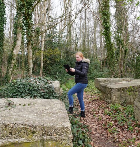
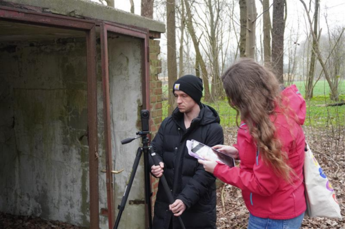
What such a visual record can achieve and where it reaches its limits has been explored by students in years 11 and 12 of the Georgianum secondary school in Lingen, who in June 2025 tested the digital tours at the Esterwegen Memorial and supplemented them with texts of their own. The tours, in their assessment, had given them a spatial sense of how many camps there were, but could not replace a visit to the memorial in person.8 The digital offering thus makes accessible a system that cannot be read from any single site, without thereby diminishing the significance of the historical site itself.
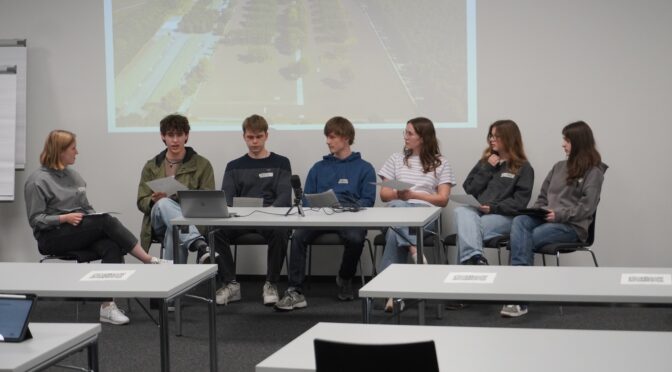
This question concerning the relationship between analogue and digital approaches was pursued further by Imke Selle in January 2026, when she organized two excursions with students to the Neuengamme Concentration Camp Memorial, one in person and the other as an online tour. In her dissertation on “Practices of the Digital Production of Historical Culture Using the Example of the Emsland Camps,” she incorporates the practices of our own project, for anyone who surveys, digitizes, and adds camp sites to guided tours is intervening in their interpretation.
What Comes Next?
Three ongoing and forthcoming projects underscore the significance of the Emsland as a subject of research for the Osnabrück Professorship for Contemporary History and Historical Migration Studies. In October 2026, the project “Moorland Landscapes as Spaces of Intervention” will begin in collaboration with the Emsland Moormuseum in Geeste, examining the socio-ecological transformation of the Bourtanger Moor between 1945 and 2025. It asks under what conditions democratic societies abandon a development path once taken — a path whose prehistory includes the camps, since the SS, SA, and prison administration forced prisoners to labor in the moor from 1933 onwards. Together with the Emsland district authority, we are currently compiling a handbook on the history of the Emsland during the National Socialist period, which is scheduled to appear in 2028. The next three volumes of the series “Konfliktlandschaften” [Conflict Landscapes] are also devoted to the Emsland: Volumes 4 and 5 will emerge from the Emsland Camps and the Moorland Landscapes projects respectively, while Volume 6 will, in consultation with the Esterwegen Memorial, address the cemeteries of the Emsland Camps.
For the concept of the conflict landscape, the Emsland thus serves as a testing ground. Its camp sites display transformations of every kind, from agricultural land to industrial estates to memorial sites, while the project documents this transformation and simultaneously adds a further, digital layer to it. Whether the concept can explain what a site without any visible trace still bears witness to, and what a digital experience can achieve alongside a physical visit to the site, will be demonstrated by Imke Selle’s study, which she is expected to complete in 2027 — and her findings will also concern the guided tours that we ourselves have produced.
- Gedenkstätte Esterwegen: Kriegsgräberstätte Dalum, accessed 24 September 2026. ↩
- Christoph Rass: Einleitung, in: ders. (Hg.): Der ›Hürtgenwald‹ im Kontext. Ereignishorizont, Erinnerungspolitik und Geschichtskultur (Konfliktlandschaften 3), Göttingen: V&R unipress / Universitätsverlag Osnabrück 2026; Research Revisited: Twelve Years of the Interdisciplinary Working Group Conflict Landscapes at the University of Osnabrück, accessed 23 September 2026. ↩
- Rass (Hg.): Der ›Hürtgenwald‹ im Kontext (as in n. 2); Team NGHM: Out Now | Konfliktlandschaften Band 3: Der Hürtgenwald im Kontext, NGHM@UOS, 14 September 2026; Frank Möller: »Einer gewaltigen Übermacht ehrenvoll unterlegen …?« Militaria-Literatur über den Zweiten Weltkrieg am Beispiel des Kriegsschauplatzes Nordeifel/›Hürtgenwald‹ (Konfliktlandschaften 2), Göttingen: V&R unipress 2022. ↩
- Karya 1943. Zwangsarbeit und Holocaust, accessed 23 September 2026. ↩
- Gedenkstätte Esterwegen: Die Emslandlager, accessed 28 September 2026; Sebastian Weitkamp / Martin Koers (Hg.): Hölle im Moor. Die Emslandlager 1933–1945, Göttingen: Wallstein 2025; David Reinicke: Die ›Moor-SA‹. Siedlungspolitik und Strafgefangenenlager im Emsland 1934–1942, Göttingen: Wallstein 2022. ↩
- Gedenkstätte Esterwegen: Lager XII Dalum, accessed 24 September 2026; Gedenkstätte Esterwegen: Nachkriegsnutzung ab 1945, accessed 29 September 2026. ↩
- Lea Horstmann / Imke Selle / Lina-Sofie Winkler: Abschluss der Digitalisierungkampagne im Projekt »Die Emslandlager als Konfliktlandschaft in Transformation« an den ehemaligen Lagerstandorten Versen und Groß-Hesepe, NGHM@UOS, 06 August 2024, https://doi.org/10.58079/12540; Boden|Spuren: Lager II Aschendorfermoor; Gemeinde Geeste: Erinnerungsort »Lager XII Dalum«; Gedenkstätte Esterwegen: VI Oberlangen and Die Emslandlager, accessed 29 September 2026. ↩
- Imke Selle: Digital Public History-Workshop »Die ›Emslandlager‹ als Konfliktlandschaft in Transformation«, NGHM@UOS, 29 July 2025, https://doi.org/10.58079/14g43. ↩
Find the original post at Gewaltorte, Spuren und digitale Geschichtskultur | »Die ›Emslandlager‹ als Konfliktlandschaft in Transformation«, Osnabrück und Dalum, 24. und 25. September 2026. on nghm.hypotheses.org.
This post was automatically translated from the German original.